- Home
- Councils
- Unitary authorities
- Somerset
Unitary authorityCurrentE06000066
Somerset Council
Local authority area: Somerset
Somerset is an unitary authority, in the South West England region of England. It covers 3,450.6 km² and had 576,852 residents in 2022 — about 167 people per km².
Town hall in the administrative centreCounty Hall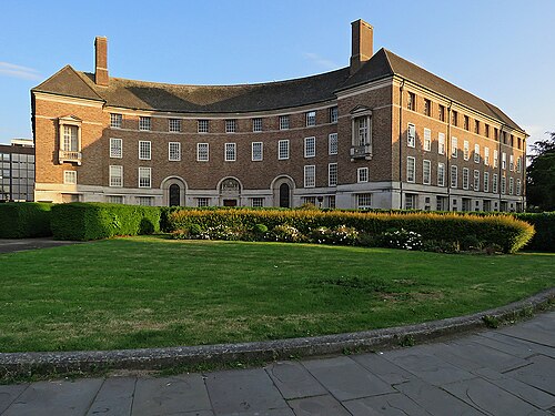
Photo: John Sutton · CC BY-SA 2.0 · Wikimedia Commons
People
Population
Estimates recorded for Somerset, 2012–2022.
Residents, 2022576,852+7.8% since 2012
Land area3,450.6km²1,332.3 sq mi
Density167/ km²people per square kilometre
Rank by population#25of 382 UK councils · #24 in England
Population estimates3 data points
535K559.4K576.9K
201220182022
Same region, same type
All councils in South WestOther unitary authorities in South West
Elections
55 electoral wards
Census 2021: 571,543 residents in 250,125 households across the wards; 24.8% aged 65+, 67.4% of homes owned, 14.0% of households without a car.
1Frome East5,490 households · 18.1% aged 65+13,1282Wellington5,878 households · 24.9% aged 65+13,0403Monkton & North Curry5,340 households · 21.9% aged 65+12,8934Street5,258 households · 21.2% aged 65+12,7065Bridgwater East & Bawdrip5,338 households · 19.6% aged 65+12,2916Bridgwater South5,262 households · 17.3% aged 65+12,018
Visit
Council offices
Offices, town halls and local council offices in the area.
CChildrens CentreCouncil office · Langport TA10 9RY · hours listedCSupport Services for EducationCouncil office · Taunton TA1 4DY · hours listedTChard GuildhallTown hall · Chard TA20 1PP · hours listedTSomerton Town CouncilTown council · Somerton TA11 6SB · hours listedPNether Stowey Parish CouncilParish council · Bridgwater TA5 1LN · hours listedPWestonzoyland Parish CouncilParish council · Bridgwater TA6 5SA · hours listed
Westminster
Constituencies
Source: Wikidata Q21694741 (CC0)Figures as recorded with their reference year; boundaries may have changed since.