- Home
- Councils
- Unitary authorities
- Bournemouth, Christchurch and Poole
Unitary authorityCurrentE06000058
Bournemouth, Christchurch and Poole Council
Local authority area: Bournemouth, Christchurch and Poole
Bournemouth, Christchurch and Poole is an unitary authority, in the South West England region of England. It covers 161.3 km² and had 401,898 residents in 2022 — about 2,492 people per km². The authority dates from 2019.
Town hall in the administrative centrePoole Civic Centre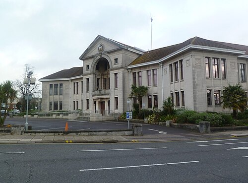
Photo: Mike Faherty · CC BY-SA 2.0 · Wikimedia Commons
People
Population
Estimates recorded for Bournemouth, Christchurch and Poole, 2015–2022.
Residents, 2022401,898+1.6% since 2015
Land area161.3km²62.3 sq mi
Density2,492/ km²people per square kilometre
Rank by population#40of 382 UK councils · #38 in England
Population estimates4 data points
395.7K395.8K400.2K401.9K
2015201820212022
History
How the council came to be
- 2019Created
Formed from Bournemouth, Poole, Christchurch, Dorset.
Same region, same type
All councils in South WestOther unitary authorities in South West
Elections
33 electoral wards
Census 2021: 400,198 residents in 173,839 households across the wards; 21.6% aged 65+, 62.8% of homes owned, 19.4% of households without a car.
1Kinson7,437 households · 20.1% aged 65+17,7952Newtown & Heatherlands7,540 households · 17.0% aged 65+17,7333East Cliff & Springbourne7,675 households · 14.2% aged 65+17,2074Muscliff & Strouden Park6,989 households · 18.8% aged 65+16,8735Alderney & Bourne Valley6,677 households · 18.7% aged 65+16,6826Bournemouth Central6,288 households · 10.9% aged 65+16,219
Visit
Council offices
Offices, town halls and local council offices in the area.
CBCP Council - Customer Service CentreCouncil office · Bournemouth BH2 6EB · hours listedTBCP Council - Civic CentreTown hall · Bournemouth BH2 6DY · hours listed
Westminster
Constituencies
Source: Wikidata Q54366459 (CC0)Figures as recorded with their reference year; boundaries may have changed since.