Unitary authorityCurrentE06000030
Swindon Borough Council
Local authority area: Swindon
Swindon is an unitary authority, in the South West England region of England. It covers 230.1 km² and had 235,657 residents in 2022 — about 1,024 people per km². The council is based in Swindon.
Town hall in the administrative centreSwindon Town Hall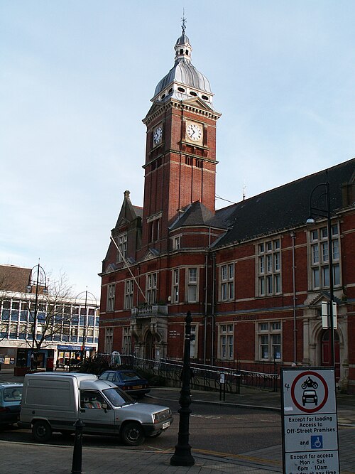
Photo: Unknown author · CC BY-SA 3.0 · Wikimedia Commons
People
Population
Estimates recorded for Swindon, 2012–2022.
Residents, 2022235,657+11.2% since 2012
Land area230.1km²88.8 sq mi
Density1,024/ km²people per square kilometre
Rank by population#111of 382 UK councils · #100 in England
Population estimates4 data points
211.9K217.2K222K235.7K
2012201520182022
Same region, same type
All councils in South WestOther unitary authorities in South West
Elections
25 electoral wards
Census 2021: 233,400 residents in 95,876 households across the wards; 15.9% aged 65+, 63.7% of homes owned, 19.4% of households without a car.
1Lydiard, Freshbrook & Toothill6,108 households · 16.4% aged 65+14,4012Queen's Park6,152 households · 8.7% aged 65+14,2693Priory Vale5,431 households · 8.1% aged 65+13,8074Old Town & Lawn5,570 households · 19.3% aged 65+13,1085Rodbourne Ferndale & Western5,346 households · 12.1% aged 65+12,7486Shaw & Westlea5,346 households · 13.8% aged 65+12,451
Visit
Council offices
Offices, town halls and local council offices in the area.
CChildren's, Families & Community Health - Reuben GeorgeCouncil office · Swindon SN3 2FD · hours listedTSwindon Borough Council (Civic Offices)Town hall · Swindon SN1 2JG · hours listedPCentral Swindon North Parish CouncilParish council · Swindon SN2 2QJ · hours listedPSt Andrews Parish CouncilParish council · Swindon SN25 5AZ · hours listedPStratton St Margaret Parish CouncilParish council · Swindon SN2 7JX · hours listedPWest Swindon Parish CouncilParish council · Swindon SN5 7YT · hours listed
Source: Wikidata Q894093 (CC0)Figures as recorded with their reference year; boundaries may have changed since.