County councilCurrentE10000030
Surrey Quarter Sessions
Local authority area: Surrey
Surrey is a county council, in the South East England region of England. It covers 1,662.5 km² and had 1,214,540 residents in 2022 — about 731 people per km².
Council headquartersSurrey County Hall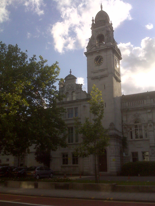
Photo: Crispness ( talk ) · CC BY-SA 3.0 · Wikimedia Commons
People
Population
Estimates recorded for Surrey, 2012–2022.
Residents, 20221,214,540+6.2% since 2012
Land area1,662.5km²641.9 sq mi
Density731/ km²people per square kilometre
Rank by population#5of 382 UK councils · #5 in England
Population estimates5 data points
1.1M1.2M1.2M1.2M1.2M
20122015201820202022
Borders
Neighbouring councils
Same region, same type
All councils in South EastOther county councils in South East
Elections
81 county electoral divisions
Divisions are built from district wards (ONS best-fit lookup); residents are the Census 2021 totals of those wards.
| Division | District | Wards | Residents |
|---|---|---|---|
| Addlestone | Runnymede | 4 | 25,794 |
| Ash | Guildford | 2 | 13,239 |
| Ashford | Spelthorne | 3 | 23,705 |
| Ashtead | Mole Valley | 2 | 14,832 |
| Bagshot, Windlesham and Chobham | Surrey Heath | 2 | 14,469 |
| Banstead, Woodmansterne and Chipstead | Reigate and Banstead | 2 | 19,817 |
| Bookham and Fetcham West | Mole Valley | 3 | 19,669 |
| Camberley East | Surrey Heath | 4 | 21,203 |
| Camberley West | Surrey Heath | 5 | 28,791 |
| Caterham Hill | Tandridge | 3 | 15,188 |
| Caterham Valley | Tandridge | 4 | 17,241 |
| Chertsey | Runnymede | 4 | 22,731 |
| Cobham | Elmbridge | 2 | 18,495 |
| Cranleigh and Ewhurst | Waverley | 3 | 14,153 |
| Dorking Hills | Mole Valley | 5 | 31,321 |
| Dorking Rural | Mole Valley | 4 | 27,313 |
| Dorking South and the Holmwoods | Mole Valley | 3 | 20,123 |
| Earlswood and Reigate South | Reigate and Banstead | 4 | 38,265 |
| East Molesey and Esher | Elmbridge | 4 | 35,809 |
| Egham | Runnymede | 4 | 26,291 |
| Englefield Green | Runnymede | 3 | 19,138 |
| Epsom Town and Downs | Epsom and Ewell | 3 | 20,306 |
| Epsom West | Epsom and Ewell | 4 | 21,419 |
| Ewell | Epsom and Ewell | 3 | 16,904 |
| Ewell Court, Auriol and Cuddington | Epsom and Ewell | 3 | 15,575 |
| Farnham Central | Waverley | 4 | 20,715 |
| Farnham North | Waverley | 4 | 18,152 |
| Farnham South | Waverley | 3 | 18,619 |
| Foxhills, Thorpe and Virginia Water | Runnymede | 4 | 22,380 |
| Frimley Green and Mytchett | Surrey Heath | 2 | 14,082 |
| Godalming North | Waverley | 4 | 23,326 |
| Godalming South, Milford and Witley | Waverley | 3 | 16,620 |
| Godstone | Tandridge | 3 | 18,353 |
| Goldsworth East and Horsell Village | Woking | 5 | 51,201 |
| Guildford East | Guildford | 2 | 15,635 |
| Guildford North | Guildford | 3 | 18,630 |
| Guildford South East | Guildford | 4 | 32,657 |
| Guildford South West | Guildford | 3 | 18,180 |
| Guildford West | Guildford | 3 | 26,460 |
| Haslemere | Waverley | 3 | 17,280 |
| Heatherside and Parkside | Surrey Heath | 3 | 17,608 |
| Hersham | Elmbridge | 5 | 43,791 |
| Hinchley Wood, Claygate and Oxshott | Elmbridge | 4 | 32,993 |
| Horley East | Reigate and Banstead | 2 | 20,113 |
| Horley West, Salfords and Sidlow | Reigate and Banstead | 3 | 30,988 |
| Horsleys | Guildford | 3 | 18,443 |
| Knaphill and Goldsworth West | Woking | 3 | 30,414 |
| Laleham and Shepperton | Spelthorne | 2 | 15,332 |
| Leatherhead and Fetcham East | Mole Valley | 4 | 24,138 |
| Lightwater, West End and Bisley | Surrey Heath | 2 | 16,873 |
| Lingfield | Tandridge | 3 | 16,736 |
| Lower Sunbury and Halliford | Spelthorne | 2 | 14,213 |
| Merstham and Banstead South | Reigate and Banstead | 5 | 52,276 |
| Nork and Tattenhams | Reigate and Banstead | 2 | 19,908 |
| Oxted | Tandridge | 4 | 20,522 |
| Redhill East | Reigate and Banstead | 4 | 39,732 |
| Redhill West and Meadvale | Reigate and Banstead | 5 | 49,664 |
| Reigate | Reigate and Banstead | 4 | 39,542 |
| Shalford | Guildford | 3 | 15,339 |
| Shere | Guildford | 4 | 26,949 |
| Staines | Spelthorne | 3 | 22,922 |
| Staines South and Ashford West | Spelthorne | 5 | 40,247 |
| Stanwell and Stanwell Moor | Spelthorne | 2 | 18,269 |
| Sunbury Common and Ashford Common | Spelthorne | 3 | 25,213 |
| Tadworth, Walton and Kingswood | Reigate and Banstead | 3 | 30,141 |
| The Byfleets | Woking | 2 | 22,074 |
| The Dittons | Elmbridge | 3 | 25,376 |
| Walton | Elmbridge | 4 | 35,713 |
| Walton South and Oatlands | Elmbridge | 5 | 43,122 |
| Warlingham | Tandridge | 4 | 15,073 |
| Waverley Eastern Villages | Waverley | 3 | 16,198 |
| Waverley Western Villages | Waverley | 4 | 19,443 |
| West Ewell | Epsom and Ewell | 4 | 23,086 |
| West Molesey | Elmbridge | 2 | 17,743 |
| Weybridge | Elmbridge | 2 | 17,331 |
| Woking North | Woking | 3 | 30,991 |
| Woking South | Woking | 3 | 30,669 |
| Woking South East | Woking | 3 | 31,149 |
| Woking South West | Woking | 4 | 41,497 |
| Woodham and New Haw | Runnymede | 4 | 26,359 |
| Worplesdon | Guildford | 2 | 16,139 |
Source: Wikidata Q23276 (CC0)Figures as recorded with their reference year; boundaries may have changed since.