- Home
- Councils
- County councils
- Oxfordshire
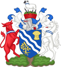
County councilCurrentE10000025
Oxfordshire County Council
Local authority area: Oxfordshire
Oxfordshire is a county council, in the South East England region of England. It covers 2,604.9 km² and had 738,276 residents in 2022 — about 283 people per km². The council is based in Oxford.
Town hall in the administrative centreOxford Town Hall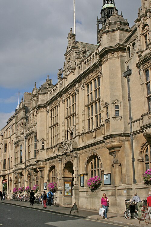
Photo: Photograph by Mike Peel ( www.mikepeel.net ). · CC BY-SA 4.0 · Wikimedia Commons
People
Population
Estimates recorded for Oxfordshire, 2012–2022.
Residents, 2022738,276+11.7% since 2012
Land area2,604.9km²1,005.8 sq mi
Density283/ km²people per square kilometre
Rank by population#17of 382 UK councils · #17 in England
Population estimates4 data points
660.8K677.8K687.5K738.3K
2012201520182022
Borders
Neighbouring councils
Same region, same type
All councils in South EastOther county councils in South East
Elections
69 county electoral divisions
Divisions are built from district wards (ONS best-fit lookup); residents are the Census 2021 totals of those wards.
| Division | District | Wards | Residents |
|---|---|---|---|
| Abingdon East | Vale of White Horse | 2 | 13,015 |
| Abingdon North | Vale of White Horse | 3 | 18,994 |
| Abingdon South | Vale of White Horse | 2 | 14,078 |
| Adderbury, Bloxham & Bodicote | Cherwell | 2 | 19,603 |
| Bampton & Carterton South | West Oxfordshire | 4 | 14,785 |
| Banbury Calthorpe | Cherwell | 4 | 42,335 |
| Banbury Easington | Cherwell | 3 | 31,912 |
| Banbury Grimsbury & Castle | Cherwell | 2 | 20,680 |
| Banbury Hardwick | Cherwell | 2 | 18,858 |
| Banbury Ruscote | Cherwell | 3 | 33,508 |
| Bartlemas | Oxford | 3 | 20,474 |
| Barton, Sandhills & Risinghurst | Oxford | 2 | 14,359 |
| Benson & Crowmarsh | South Oxfordshire | 2 | 12,657 |
| Berinsfield & Garsington | South Oxfordshire | 3 | 11,661 |
| Bicester East | Cherwell | 2 | 22,913 |
| Bicester North | Cherwell | 3 | 27,738 |
| Bicester South | Cherwell | 2 | 23,114 |
| Bicester West | Cherwell | 2 | 23,001 |
| Brize Norton & Carterton East | West Oxfordshire | 3 | 13,774 |
| Burford & Carterton West | West Oxfordshire | 5 | 16,905 |
| Chalgrove & Thame West | South Oxfordshire | 4 | 24,627 |
| Charlbury & Wychwood | West Oxfordshire | 6 | 18,624 |
| Charlton, Ardington & Hendreds | Vale of White Horse | 3 | 19,794 |
| Chesterton & Launton | Cherwell | 3 | 27,851 |
| Chinnor | South Oxfordshire | 2 | 13,689 |
| Chipping Norton | West Oxfordshire | 2 | 11,548 |
| Cholsey & The Hagbournes | South Oxfordshire | 4 | 36,899 |
| Churchill & Lye Valley | Oxford | 2 | 14,743 |
| Cowley | Oxford | 3 | 20,963 |
| Cropredy & Hook Norton | Cherwell | 2 | 18,054 |
| Deddington | Cherwell | 2 | 19,162 |
| Didcot Ladygrove | South Oxfordshire | 1 | 10,461 |
| Didcot South | South Oxfordshire | 1 | 13,231 |
| Didcot West | South Oxfordshire | 2 | 21,724 |
| Drayton, Sutton Courtenay & Steventon | Vale of White Horse | 4 | 14,724 |
| Eynsham | West Oxfordshire | 2 | 11,042 |
| Faringdon | Vale of White Horse | 2 | 16,571 |
| Goring & Woodcote | South Oxfordshire | 3 | 17,935 |
| Grove | Vale of White Horse | 2 | 10,705 |
| Hanborough & Hailey | West Oxfordshire | 3 | 11,271 |
| Harwell, Western Valley & Blewbury | Vale of White Horse | 1 | 9,240 |
| Headington & Quarry | Oxford | 3 | 20,710 |
| Henley | South Oxfordshire | 2 | 22,391 |
| Isis | Oxford | 4 | 27,145 |
| Jericho & Osney | Oxford | 2 | 14,570 |
| Kennington & Radley | Vale of White Horse | 3 | 18,296 |
| Kidlington East | Cherwell | 1 | 9,754 |
| Kidlington North & Otmoor | Cherwell | 2 | 18,214 |
| Kidlington West | Cherwell | 1 | 9,254 |
| Kingston & Stanford | Vale of White Horse | 3 | 12,121 |
| Leys | Oxford | 2 | 13,467 |
| Marcham & Cumnor | Vale of White Horse | 5 | 22,675 |
| Marston & Northway | Oxford | 2 | 13,839 |
| North Hinksey | Vale of White Horse | 2 | 13,794 |
| Parks | Oxford | 3 | 17,800 |
| Rose Hill & Littlemore | Oxford | 3 | 20,978 |
| Shrivenham | Vale of White Horse | 3 | 14,916 |
| Sonning Common & Henley South | South Oxfordshire | 2 | 20,001 |
| Summertown & Walton Manor | Oxford | 3 | 19,093 |
| Thame | South Oxfordshire | 1 | 13,268 |
| Wallingford | South Oxfordshire | 2 | 17,732 |
| Wantage West | Vale of White Horse | 3 | 18,079 |
| Watlington & Rotherfield | South Oxfordshire | 2 | 14,251 |
| Wheatley | South Oxfordshire | 3 | 11,524 |
| Witney North & East | West Oxfordshire | 2 | 11,773 |
| Witney South & Central | West Oxfordshire | 3 | 20,057 |
| Witney West & Ducklington | West Oxfordshire | 3 | 14,327 |
| Wolvercote & Cutteslowe | Oxford | 2 | 11,690 |
| Woodstock | West Oxfordshire | 3 | 10,904 |
Source: Wikidata Q23169 (CC0)Figures as recorded with their reference year; boundaries may have changed since.