- Home
- Councils
- London boroughs
- London Borough of Merton
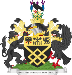
London boroughCurrentE09000024
Merton London Borough Council
Local authority area: London Borough of Merton
London Borough of Merton is a london borough, in the Greater London region of England. It covers 37.6 km² and had 214,709 residents in 2022 — about 5,707 people per km². The authority dates from 1965.
People
Population
Estimates recorded for London Borough of Merton, 2011–2022.
Residents, 2022214,709+7.1% since 2011
Land area37.6km²14.5 sq mi
Density5,707/ km²people per square kilometre
Rank by population#124of 382 UK councils · #111 in England
Population estimates5 data points
200.5K202.2K204.6K206.2K214.7K
20112012201520182022
History
How the council came to be
- 1965Created
London Borough of Merton became a local authority area.
Same region, same type
All councils in LondonOther london boroughs in London
London Borough of Croydon392,224London Borough of Barnet389,101London Borough of Ealing369,937London Borough of Newham358,645London Borough of Brent341,221London Borough of Bromley329,578London Borough of Wandsworth329,035London Borough of Enfield327,224London Borough of Tower Hamlets325,789London Borough of Lambeth316,812London Borough of Southwark311,913London Borough of Redbridge310,911
Elections
20 electoral wards
Census 2021: 215,187 residents in 81,729 households across the wards; 12.6% aged 65+, 55.6% of homes owned, 33.0% of households without a car.
1Wimbledon Town & Dundonald5,122 households · 10.3% aged 65+12,9662Raynes Park5,123 households · 12.8% aged 65+12,3013Longthornton4,106 households · 12.1% aged 65+11,9034Graveney4,178 households · 11.6% aged 65+11,8355Figge's Marsh4,212 households · 10.8% aged 65+11,8096Village4,821 households · 21.9% aged 65+11,804
Westminster
Constituencies
Source: Wikidata Q32504 (CC0)Figures as recorded with their reference year; boundaries may have changed since.