- Home
- Councils
- County councils
- Hertfordshire
County councilCurrentE10000015
Hertfordshire County Council
Local authority area: Hertfordshire
Hertfordshire is a county council, in the East of England region of England. It covers 1,643.1 km² and had 1,204,588 residents in 2022 — about 733 people per km². The council is based in Hertford.
Council headquartersCounty Hall Including Terraces And Fountain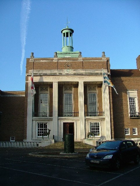
Photo: Robin Hall · CC BY-SA 2.0 · Wikimedia Commons
People
Population
Estimates recorded for Hertfordshire, 2012–2022.
Residents, 20221,204,588+6.7% since 2012
Land area1,643.1km²634.4 sq mi
Density733/ km²people per square kilometre
Rank by population#6of 382 UK councils · #6 in England
Population estimates4 data points
1.1M1.2M1.2M1.2M
2012201820202022
Same region, same type
All councils in East of EnglandOther county councils in East of England
Elections
78 county electoral divisions
Divisions are built from district wards (ONS best-fit lookup); residents are the Census 2021 totals of those wards.
| Division | District | Wards | Residents |
|---|---|---|---|
| Abbots Langley | Three Rivers | 3 | 21,952 |
| Baldock & Letchworth East | North Hertfordshire | 3 | 19,487 |
| Bedwell | Stevenage | 3 | 23,709 |
| Berkhamsted | Dacorum | 3 | 18,781 |
| Bishop's Stortford East | East Hertfordshire | 3 | 20,709 |
| Bishop's Stortford Rural | East Hertfordshire | 4 | 19,732 |
| Bishop's Stortford West | East Hertfordshire | 4 | 28,572 |
| Borehamwood North | Hertsmere | 2 | 18,342 |
| Borehamwood South | Hertsmere | 3 | 26,818 |
| Bridgewater | Dacorum | 4 | 17,869 |
| Broadwater | Stevenage | 5 | 31,782 |
| Buntingford | East Hertfordshire | 4 | 20,813 |
| Bushey North | Hertsmere | 3 | 20,813 |
| Bushey South | Hertsmere | 4 | 25,514 |
| Central Watford & Oxhey | Watford | 3 | 24,765 |
| Chells | Stevenage | 3 | 22,637 |
| Cheshunt Central | Broxbourne | 4 | 39,031 |
| Colney Heath & Marshalswick | St Albans | 4 | 22,417 |
| Croxley | Three Rivers | 3 | 21,190 |
| Flamstead End & Turnford | Broxbourne | 3 | 30,017 |
| Goffs Oak & Bury Green | Broxbourne | 2 | 19,050 |
| Haldens | Welwyn Hatfield | 4 | 25,243 |
| Handside & Peartree | Welwyn Hatfield | 3 | 22,288 |
| Harpenden North East | St Albans | 2 | 16,064 |
| Harpenden Rural | St Albans | 6 | 40,165 |
| Harpenden South West | St Albans | 2 | 15,356 |
| Hatfield East | Welwyn Hatfield | 3 | 27,824 |
| Hatfield North | Welwyn Hatfield | 2 | 18,943 |
| Hatfield Rural | Welwyn Hatfield | 2 | 12,985 |
| Hatfield South | Welwyn Hatfield | 3 | 29,685 |
| Hemel Hempstead East | Dacorum | 2 | 15,790 |
| Hemel Hempstead North East | Dacorum | 2 | 15,026 |
| Hemel Hempstead North West | Dacorum | 3 | 23,827 |
| Hemel Hempstead South East | Dacorum | 4 | 29,830 |
| Hemel Hempstead St. Pauls | Dacorum | 4 | 27,040 |
| Hemel Hempstead Town | Dacorum | 3 | 26,238 |
| Hertford All Saints | East Hertfordshire | 2 | 19,022 |
| Hertford Rural | East Hertfordshire | 4 | 14,013 |
| Hertford St. Andrews | East Hertfordshire | 4 | 29,420 |
| Hitchin North | North Hertfordshire | 2 | 15,868 |
| Hitchin Rural | North Hertfordshire | 4 | 14,077 |
| Hitchin South | North Hertfordshire | 5 | 35,224 |
| Hoddesdon North | Broxbourne | 2 | 19,948 |
| Hoddesdon South | Broxbourne | 5 | 49,226 |
| Kings Langley | Dacorum | 2 | 14,785 |
| Knebworth & Codicote | North Hertfordshire | 4 | 15,621 |
| Letchworth North | North Hertfordshire | 3 | 16,975 |
| Letchworth South | North Hertfordshire | 4 | 27,516 |
| London Colney | St Albans | 4 | 26,591 |
| Meriden Tudor | Watford | 4 | 31,471 |
| Nascot Park | Watford | 4 | 35,992 |
| North Watford | Watford | 5 | 41,258 |
| Old Stevenage | Stevenage | 4 | 25,668 |
| Potters Bar East | Hertsmere | 4 | 22,543 |
| Potters Bar West & Shenley | Hertsmere | 4 | 26,539 |
| Rickmansworth East & Oxhey Park | Three Rivers | 4 | 28,315 |
| Rickmansworth West | Three Rivers | 4 | 29,751 |
| Royston East & Ermine | North Hertfordshire | 4 | 20,234 |
| Royston West & Rural | North Hertfordshire | 8 | 31,251 |
| Sawbridgeworth | East Hertfordshire | 6 | 28,242 |
| Shephall | Stevenage | 3 | 19,378 |
| South Oxhey & Eastbury | Three Rivers | 4 | 28,536 |
| St. Albans Central | St Albans | 5 | 40,107 |
| St. Albans East | St Albans | 3 | 23,789 |
| St. Albans North | St Albans | 3 | 19,407 |
| St. Albans South | St Albans | 3 | 23,468 |
| St. Nicholas | Stevenage | 3 | 19,104 |
| St. Stephen's | St Albans | 2 | 16,389 |
| Three Rivers Rural | Three Rivers | 4 | 28,288 |
| Tring | Dacorum | 4 | 16,386 |
| Waltham Cross | Broxbourne | 2 | 21,302 |
| Ware North | East Hertfordshire | 4 | 21,125 |
| Ware South | East Hertfordshire | 4 | 22,266 |
| Watling | Hertsmere | 3 | 15,158 |
| Welwyn | Welwyn Hatfield | 3 | 18,770 |
| Welwyn Garden City South | Welwyn Hatfield | 3 | 20,504 |
| West Watford | Watford | 4 | 34,863 |
| Woodside Stanborough | Watford | 2 | 15,555 |
Visit
Council offices
Offices, town halls and local council offices in the area.
Source: Wikidata Q3410 (CC0)Figures as recorded with their reference year; boundaries may have changed since.