County councilCurrentE10000012
Essex County Council
Local authority area: Essex
Essex is a county council, in the East of England region of England. It covers 3,464.4 km² and had 1,519,509 residents in 2022 — about 439 people per km².
Council headquartersCounty Hall, Chelmsford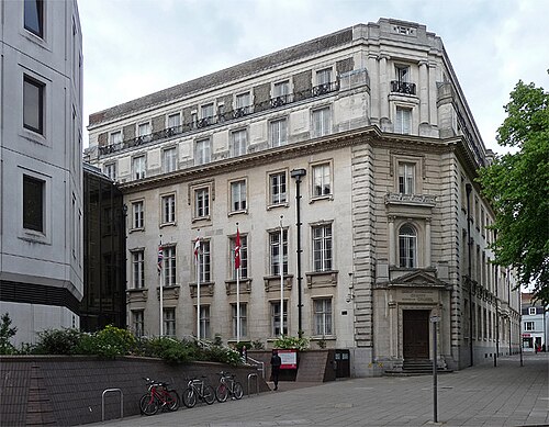
Photo: Stephen Richards · CC BY-SA 2.0 · Wikimedia Commons
People
Population
Estimates recorded for Essex, 2012–2022.
Residents, 20221,519,509+8.0% since 2012
Land area3,464.4km²1,337.6 sq mi
Density439/ km²people per square kilometre
Rank by population#2of 382 UK councils · #2 in England
Population estimates3 data points
1.4M1.5M1.5M
201220182022
Same region, same type
All councils in East of EnglandOther county councils in East of England
Elections
70 county electoral divisions
Divisions are built from district wards (ONS best-fit lookup); residents are the Census 2021 totals of those wards.
| Division | District | Wards | Residents |
|---|---|---|---|
| Abbey | Colchester | 3 | 38,748 |
| Basildon Laindon Park and Fryerns | Basildon | 4 | 57,628 |
| Basildon Pitsea | Basildon | 4 | 54,216 |
| Basildon Westley Heights | Basildon | 2 | 28,322 |
| Billericay and Burstead | Basildon | 3 | 37,130 |
| Bocking | Braintree | 3 | 22,276 |
| Braintree Eastern | Braintree | 5 | 38,559 |
| Braintree Town | Braintree | 5 | 39,363 |
| Brentwood Hutton | Brentwood | 4 | 23,233 |
| Brentwood North | Brentwood | 4 | 24,600 |
| Brentwood Rural | Brentwood | 4 | 24,336 |
| Brentwood South | Brentwood | 6 | 35,245 |
| Brightlingsea | Tendring | 4 | 24,270 |
| Broomfield and Writtle | Chelmsford | 4 | 26,508 |
| Buckhurst Hill and Loughton South | Epping Forest | 4 | 30,634 |
| Canvey Island East | Castle Point | 3 | 21,699 |
| Canvey Island West | Castle Point | 3 | 24,269 |
| Chelmer | Chelmsford | 3 | 26,121 |
| Chelmsford Central | Chelmsford | 3 | 27,500 |
| Chelmsford North | Chelmsford | 2 | 18,361 |
| Chelmsford West | Chelmsford | 3 | 21,339 |
| Chigwell and Loughton Broadway | Epping Forest | 4 | 32,567 |
| Clacton East | Tendring | 5 | 25,609 |
| Clacton North | Tendring | 5 | 33,527 |
| Clacton West | Tendring | 6 | 33,518 |
| Constable | Colchester | 3 | 31,566 |
| Drury | Colchester | 3 | 34,725 |
| Dunmow | Uttlesford | 6 | 27,735 |
| Epping and Theydon Bois | Epping Forest | 4 | 27,334 |
| Frinton and Walton | Tendring | 6 | 22,527 |
| Great Baddow | Chelmsford | 4 | 33,948 |
| Hadleigh | Castle Point | 5 | 32,003 |
| Halstead | Braintree | 5 | 27,520 |
| Harlow North | Harlow | 5 | 38,681 |
| Harlow South East | Harlow | 3 | 26,307 |
| Harlow West | Harlow | 6 | 52,177 |
| Harwich | Tendring | 5 | 19,769 |
| Hedingham | Braintree | 7 | 26,432 |
| Heybridge and Tollesbury | Maldon | 6 | 22,945 |
| Loughton Central | Epping Forest | 4 | 30,116 |
| Maldon | Maldon | 6 | 22,153 |
| Maypole | Colchester | 2 | 23,673 |
| Mersea and Tiptree | Colchester | 3 | 30,636 |
| Mile End and Highwoods | Colchester | 3 | 34,344 |
| North Weald and Nazeing | Epping Forest | 4 | 30,115 |
| Ongar and Rural | Epping Forest | 4 | 30,745 |
| Parsons Heath and East Gates | Colchester | 3 | 36,777 |
| Rayleigh North | Rochford | 3 | 20,195 |
| Rayleigh South | Rochford | 4 | 26,541 |
| Rochford North | Rochford | 4 | 25,357 |
| Rochford South | Rochford | 3 | 20,389 |
| Rochford West | Rochford | 3 | 19,350 |
| Saffron Walden | Uttlesford | 6 | 25,589 |
| South Benfleet | Castle Point | 5 | 34,239 |
| South Woodham Ferrers | Chelmsford | 2 | 16,026 |
| Southminster | Maldon | 6 | 24,797 |
| Springfield | Chelmsford | 3 | 22,719 |
| Stansted | Uttlesford | 7 | 30,262 |
| Stanway and Pyefleet | Colchester | 5 | 54,619 |
| Stock | Chelmsford | 4 | 26,120 |
| Tendring Rural East | Tendring | 8 | 30,674 |
| Tendring Rural West | Tendring | 7 | 31,114 |
| Thaxted | Uttlesford | 7 | 27,183 |
| Three Fields with Great Notley | Braintree | 3 | 18,740 |
| Thundersley | Castle Point | 4 | 25,513 |
| Waltham Abbey | Epping Forest | 3 | 22,857 |
| Wickford Crouch | Basildon | 4 | 50,810 |
| Witham Northern | Braintree | 6 | 43,124 |
| Witham Southern | Braintree | 4 | 25,798 |
| Wivenhoe St. Andrew | Colchester | 2 | 23,655 |
Source: Wikidata Q21272241 (CC0)Figures as recorded with their reference year; boundaries may have changed since.