- Home
- Councils
- Unitary authorities
- Herefordshire

Unitary authorityCurrentE06000019
Herefordshire Council
Local authority area: Herefordshire
Herefordshire is an unitary authority, in the West Midlands region of England. It covers 2,179.7 km² and had 188,719 residents in 2022 — about 87 people per km². The council is based in Hereford.
Town hall in the administrative centreTown Hall, Hereford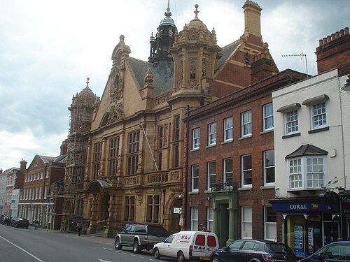
Photo: Trevor Rickard · CC BY-SA 2.0 · Wikimedia Commons
People
Population
Estimates recorded for Herefordshire, 2011–2022.
Residents, 2022188,719+2.9% since 2011
Land area2,179.7km²841.6 sq mi
Density87/ km²people per square kilometre
Rank by population#140of 382 UK councils · #127 in England
Population estimates8 data points
183.5K184.9K188.1K189.3K192.1K193.6K187K188.7K
20112012201520162018202020212022
History
How the council came to be
- —Predecessors
Hereford and Worcester
Borders
Neighbouring councils
Same region, same type
All councils in West MidlandsOther unitary authorities in West Midlands
Elections
53 electoral wards
Census 2021: 187,027 residents in 82,824 households across the wards; 25.9% aged 65+, 66.4% of homes owned, 14.4% of households without a car.
1Newton Farm1,812 households · 12.8% aged 65+4,5282Hinton & Hunderton1,963 households · 16.2% aged 65+4,3833Hagley1,767 households · 20.4% aged 65+4,2984Leominster East2,132 households · 26.7% aged 65+4,2615Holmer1,752 households · 20.7% aged 65+4,2286Saxon Gate1,670 households · 13.9% aged 65+4,040
Visit
Council offices
Offices, town halls and local council offices in the area.
CHerefordshire Archive and Records CentreCouncil office · Hereford HR2 6LA · hours listedCHerefordshire CouncilCouncil office · Hereford HR4 0LE · hours listedCHerefordshire Council Trading StandardsCouncil office · Hereford HR1 2PJ · hours listedTHereford Town HallTown hall · Hereford HR1 2PJ · hours listedTHereford City CouncilTown council · Hereford HR1 2PJ · hours listedTKington Town CouncilTown council · Kington HR5 3DP · hours listed
Westminster
Constituencies
Source: Wikidata Q23129 (CC0)Figures as recorded with their reference year; boundaries may have changed since.