- Home
- Councils
- District councils
- Dartford
District councilCurrentE07000107
Dartford Borough Council
Local authority area: Dartford
Dartford is a district council in Kent, in the South East England region of England. It covers 72.8 km² and had 118,820 residents in 2022 — about 1,633 people per km². The council is based in Dartford.
Town hall in the administrative centreDartford Civic Centre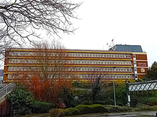
Photo: Richard Kelly · CC BY 4.0 · Wikimedia Commons
People
Population
Estimates recorded for Dartford, 2011–2022.
Residents, 2022118,820+21.7% since 2011
Land area72.8km²28.1 sq mi
Density1,633/ km²people per square kilometre
Rank by population#264of 382 UK councils · #224 in England
Population estimates5 data points
97.6K98.9K103.9K109.7K118.8K
20112012201520182022
Elections
20 electoral wards
Census 2021: 116,752 residents in 45,698 households across the wards; 13.8% aged 65+, 65.7% of homes owned, 16.8% of households without a car.
1Temple Hill3,731 households · 11.3% aged 65+9,3342West Hill3,135 households · 14.1% aged 65+8,2193Wilmington, Sutton-at-Hone & Hawley3,171 households · 21.5% aged 65+7,9124Swanscombe3,098 households · 11.2% aged 65+7,8845Stone Castle3,269 households · 7.7% aged 65+7,8556Greenhithe & Knockhall3,121 households · 10.4% aged 65+7,483
Visit
Council offices
Offices, town halls and local council offices in the area.
CDartford Borough CouncilCouncil office · Dartford DA1 1DR · hours listedCSwanscombe Family HubCouncil office · Swanscombe DA10 0BS · hours listedPLongfield & New Barn Parish CouncilParish council · Longfield DA3 7QP · hours listed
Westminster
Constituencies
Source: Wikidata Q894082 (CC0)Figures as recorded with their reference year; boundaries may have changed since.