- Home
- Councils
- Unitary authorities
- City of Nottingham
Unitary authorityCurrentE06000018
Nottingham City Council
Local authority area: City of Nottingham
City of Nottingham is an unitary authority, in the East Midlands region of England. It covers 74.6 km² and had 328,513 residents in 2022 — about 4,403 people per km². The council is based in Nottingham.
Town hall in the administrative centreNottingham Council House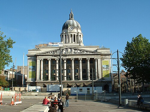
Photo: Necrothesp at English Wikipedia · CC BY-SA 3.0 · Wikimedia Commons
People
Population
Estimates recorded for City of Nottingham, 2012–2022.
Residents, 2022328,513+6.4% since 2012
Land area74.6km²28.8 sq mi
Density4,403/ km²people per square kilometre
Rank by population#61of 382 UK councils · #55 in England
Population estimates4 data points
308.7K318.9K331.1K328.5K
2012201520182022
Same region, same type
All councils in East MidlandsOther unitary authorities in East Midlands
Elections
20 electoral wards
Census 2021: 323,635 residents in 124,745 households across the wards; 11.7% aged 65+, 45.2% of homes owned, 38.0% of households without a car.
1Hyson Green & Arboretum6,875 households · 4.9% aged 65+23,3382Lenton & Wollaton East5,773 households · 6.1% aged 65+21,8293St. Ann's7,914 households · 7.9% aged 65+20,6854Aspley6,745 households · 8.1% aged 65+18,7955Berridge6,721 households · 8.3% aged 65+17,9116Bestwood7,363 households · 13.9% aged 65+17,065
Visit
Council offices
Offices, town halls and local council offices in the area.
CNottingham Counselling & Natural Health CentreCouncil office · Nottingham NG2 2JY · hours listedCThe Island QuarterCouncil office · Nottingham NG2 4LACThe Mary Potter CentreCouncil office · Nottingham NG7 5HYTNottingham City CouncilTown council · Nottingham NG2 4UU · hours listed
Westminster
Constituencies
Source: Wikidata Q21885994 (CC0)Figures as recorded with their reference year; boundaries may have changed since.