- Home
- Councils
- Welsh principal councils
- Carmarthenshire
Welsh principal councilCurrentW06000010
Carmarthenshire
Sir Gaerfyrddin
Carmarthenshire is a welsh principal council in Wales. It covers 2,370.3 km² and had 187,568 residents in 2018 — about 79 people per km². The council is based in Carmarthen.
Town hall in the administrative centreCarmarthen Guildhall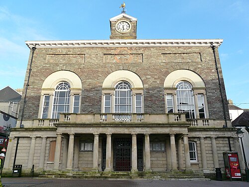
Photo: Ham · CC BY-SA 3.0 · Wikimedia Commons
People
Population
Estimates recorded for Carmarthenshire, 2001–2018.
Residents, 2018187,568+8.5% since 2001
Land area2,370.3km²915.2 sq mi
Density79/ km²people per square kilometre
Rank by population#142of 382 UK councils · #4 in Wales
Population estimates3 data points
172.8K183.8K187.6K
200120112018
Same region, same type
All councils in WalesOther welsh principal councils in Wales
Elections
51 electoral wards
Census 2021: 187,893 residents in 81,761 households across the wards; 24.2% aged 65+, 70.4% of homes owned, 15.4% of households without a car.
1Carmarthen Town North and South4,317 households · 22.7% aged 65+9,1112Bigyn2,779 households · 19.2% aged 65+6,5873Glanymor2,903 households · 17.6% aged 65+6,4094Cenarth and Llangeler2,468 households · 30.0% aged 65+5,5505Carmarthen Town West2,283 households · 14.5% aged 65+5,5216Ammanford2,464 households · 23.4% aged 65+5,439
Visit
Council offices
Offices, town halls and local council offices in the area.
Westminster
Constituencies
Source: Wikidata Q217840 (CC0)Figures as recorded with their reference year; boundaries may have changed since.