Metropolitan boroughCurrentE08000010
Wigan Metropolitan Borough Council
Local authority area: Wigan
Wigan is a metropolitan borough, in the North West England region of England. It covers 188.2 km² and had 334,110 residents in 2022 — about 1,776 people per km². The authority dates from 1974. The council is based in Wigan.
Town hall in the administrative centreWigan Town Hall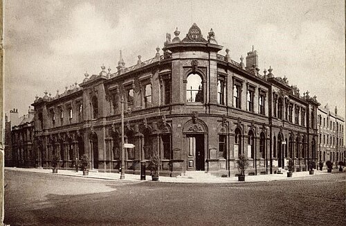
Photo: Unknown author Unknown author · Public domain · Wikimedia Commons
People
Population
Estimates recorded for Wigan, 1971–2022.
Residents, 2022334,110+10.3% since 1971
Land area188.2km²72.7 sq mi
Density1,776/ km²people per square kilometre
Rank by population#58of 382 UK councils · #52 in England
Population estimates10 data points
302.9K307.7K310.9K301.4K317.8K318.7K322K326.1K330.7K334.1K
1971198119912001201120122015201820202022
History
How the council came to be
- 1974Created
Formed from Atherton Urban District.
Same region, same type
All councils in North WestOther metropolitan boroughs in North West
Elections
25 electoral wards
Census 2021: 329,323 residents in 143,101 households across the wards; 19.3% aged 65+, 66.4% of homes owned, 21.3% of households without a car.
1Leigh Central & Higher Folds8,037 households · 15.9% aged 65+17,5432Abram6,466 households · 15.4% aged 65+15,8253Standish with Langtree6,388 households · 20.5% aged 65+14,9524Atherton South & Lilford6,488 households · 20.5% aged 65+14,2455Wigan West6,264 households · 17.2% aged 65+14,1316Hindley Green5,889 households · 20.4% aged 65+14,041
Visit
Council offices
Offices, town halls and local council offices in the area.
CWigan CouncilCouncil office · Wigan WN1 1YN · hours listedCWigan Register officeCouncil office · Wigan WN1 1NH · hours listedTLeigh Town HallTown hall · Leigh WN7 1DYTWigan Town HallTown hall · Wigan WN1 1DF
Westminster
Constituencies
Source: Wikidata Q684307 (CC0)Figures as recorded with their reference year; boundaries may have changed since.