- Home
- Councils
- Metropolitan boroughs
- Gateshead
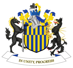
Metropolitan boroughCurrentE08000037
Gateshead Metropolitan Borough Council
Local authority area: Gateshead
Gateshead is a metropolitan borough, in the North East England region of England. It covers 142.4 km² and had 197,722 residents in 2022 — about 1,389 people per km². The authority dates from 1974.
People
Population
Estimates recorded for Gateshead, 2012–2022.
Residents, 2022197,722-1.2% since 2012
Land area142.4km²55.0 sq mi
Density1,389/ km²people per square kilometre
Rank by population#133of 382 UK councils · #120 in England
Population estimates4 data points
200.2K201K202.5K197.7K
2012201520182022
History
How the council came to be
- 1974Created
Formed from County Borough of Gateshead, Ryton Urban District, Blaydon Urban District.
Same region, same type
All councils in North EastOther metropolitan boroughs in North East
Elections
22 electoral wards
Census 2021: 196,149 residents in 88,990 households across the wards; 20.3% aged 65+, 58.0% of homes owned, 32.4% of households without a car.
1Saltwell5,469 households · 11.0% aged 65+13,2842Blaydon4,770 households · 18.3% aged 65+10,4663Whickham South & Sunniside4,419 households · 29.6% aged 65+9,8534Ryton, Crookhill & Stella4,417 households · 22.9% aged 65+9,8485Birtley North & Lamesley4,145 households · 19.5% aged 65+9,4856High Fell4,125 households · 16.2% aged 65+9,403
Visit
Council offices
Offices, town halls and local council offices in the area.
Source: Wikidata Q929034 (CC0)Figures as recorded with their reference year; boundaries may have changed since.