- Home
- Councils
- Unitary authorities
- West Berkshire
Unitary authorityCurrentE06000037
West Berkshire Council
Local authority area: West Berkshire
West Berkshire is an unitary authority, in the South East England region of England. It covers 704.2 km² and had 162,215 residents in 2022 — about 230 people per km². The authority dates from 1974. The council is based in Newbury.
Town hall in the administrative centreTown Hall And Municipal Buildings, Newbury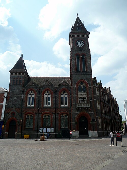
Photo: Tom Bastin from Reading, UK · CC BY 2.0 · Wikimedia Commons
People
Population
Estimates recorded for West Berkshire, 2012–2022.
Residents, 2022162,215+5.0% since 2012
Land area704.2km²271.9 sq mi
Density230/ km²people per square kilometre
Rank by population#169of 382 UK councils · #149 in England
Population estimates4 data points
154.5K156K158.5K162.2K
2012201520182022
History
How the council came to be
- 1974Created
West Berkshire became a local authority area.
Same region, same type
All councils in South EastOther unitary authorities in South East
Elections
24 electoral wards
Census 2021: 161,445 residents in 66,658 households across the wards; 19.5% aged 65+, 67.6% of homes owned, 12.1% of households without a car.
1Newbury Greenham5,670 households · 13.2% aged 65+12,8302Hungerford & Kintbury5,039 households · 24.4% aged 65+11,4463Burghfield & Mortimer4,332 households · 20.0% aged 65+10,7634Tilehurst & Purley4,166 households · 20.9% aged 65+10,6405Newbury Wash Common3,643 households · 23.3% aged 65+9,3186Chieveley & Cold Ash2,776 households · 17.7% aged 65+8,224
Visit
Council offices
Offices, town halls and local council offices in the area.
CWest Berkshire Childrens' ServicesCouncil office · Newbury RG14 1BD · hours listedCWest Berkshire CouncilCouncil office · Newbury RG14 5LD · hours listedTHungerford Town HallTown hall · Hungerford RG17 0NF · hours listedPLambourn Parish CouncilParish council · Hungerford RG17 8XP · hours listedPStratfield Mortimer Parish CouncilParish council · Reading RG7 3SH · hours listed
Westminster
Constituencies
Source: Wikidata Q1473780 (CC0)Figures as recorded with their reference year; boundaries may have changed since.