- Home
- Councils
- Unitary authorities
- East Riding of Yorkshire
Unitary authorityCurrentE06000011
East Riding of Yorkshire Council
Local authority area: East Riding of Yorkshire
East Riding of Yorkshire is an unitary authority, in the Yorkshire and the Humber region of England. It covers 2,405.3 km² and had 346,309 residents in 2022 — about 144 people per km².
Town hall in the administrative centreCounty Hall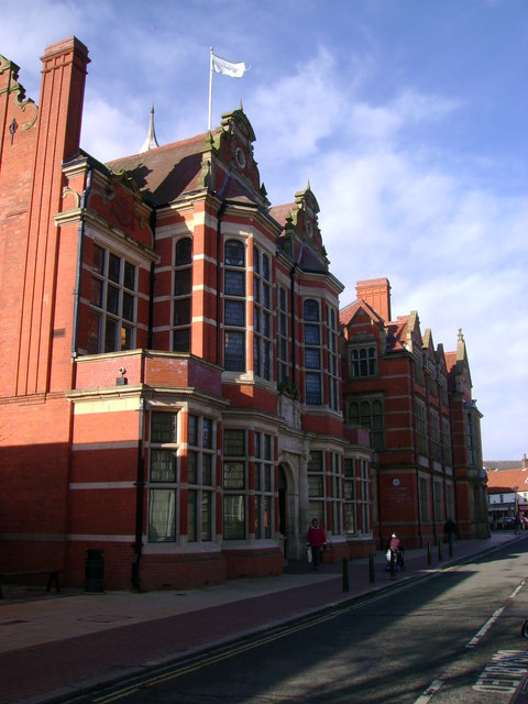
Photo: martin dawes · CC BY-SA 2.0 · Wikimedia Commons
People
Population
Estimates recorded for East Riding of Yorkshire, 2012–2022.
Residents, 2022346,309+3.1% since 2012
Land area2,405.3km²928.7 sq mi
Density144/ km²people per square kilometre
Rank by population#53of 382 UK councils · #49 in England
Population estimates4 data points
335.9K336.7K339.6K346.3K
2012201520182022
Same region, same type
All councils in Yorkshire and the HumberOther unitary authorities in Yorkshire and the Humber
Elections
26 electoral wards
Census 2021: 342,212 residents in 152,067 households across the wards; 26.4% aged 65+, 73.1% of homes owned, 15.8% of households without a car.
1Pocklington Provincial8,310 households · 26.0% aged 65+18,6192Dale7,408 households · 22.3% aged 65+17,2853Wolds Weighton7,169 households · 23.1% aged 65+17,1954Minster and Woodmansey7,652 households · 23.4% aged 65+16,3595St Mary's7,452 households · 27.4% aged 65+15,9576Howdenshire6,485 households · 23.2% aged 65+15,838
Visit
Council offices
Offices, town halls and local council offices in the area.
CEast Riding Health and WellbeingCouncil office · Beverley HU17 9BA · hours listedCEast Riding of Yorkshire CouncilCouncil office · Beverley HU17 9BA · hours listedTMarket Weighton Town CouncilTown council · York YO43 3AQ · hours listedTSnaith & Cowick Town CouncilTown council · Goole DN14 9HE · hours listedPNorth Cave Parish CouncilParish council · Brough HU15 2JH · hours listedPSkidby Parish CouncilParish council · Cottingham HU16 5TXPSouth Cave Parish CouncilParish council · Brough HU15 2AT · hours listedPThorngumbald Parish CouncilParish council · Hull HU12 9NG · hours listedPTickton & Routh Parish CouncilParish council · Beverley HU17 9RT · hours listedPWilberfoss Parish CouncilParish council · York YO41 5LX
Westminster
Constituencies
Source: Wikidata Q21695028 (CC0)Figures as recorded with their reference year; boundaries may have changed since.