- Home
- Councils
- Unitary authorities
- Cheshire East

Unitary authorityCurrentE06000049
Cheshire East Council
Local authority area: Cheshire East
Cheshire East is an unitary authority, in the North West England region of England. It covers 1,166.4 km² and had 406,527 residents in 2022 — about 349 people per km². The authority dates from 2009. The council is based in Sandbach.
Town hall in the administrative centreThe Municipal Buildings, Sandbach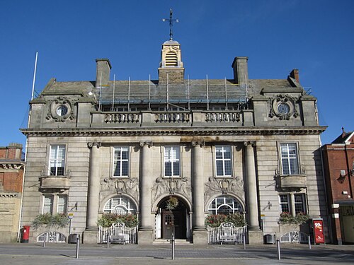
Photo: John S Turner · CC BY-SA 2.0 · Wikimedia Commons
People
Population
Estimates recorded for Cheshire East, 1991–2022.
Residents, 2022406,527+19.4% since 1991
Land area1,166.4km²450.3 sq mi
Density349/ km²people per square kilometre
Rank by population#39of 382 UK councils · #37 in England
Population estimates7 data points
340.5K352.1K370.7K372.1K375.4K380.8K406.5K
1991200120112012201520182022
History
How the council came to be
- 2009Created
Cheshire East became a local authority area.
Borders
Neighbouring councils
Same region, same type
All councils in North WestOther unitary authorities in North West
Elections
52 electoral wards
Census 2021: 398,769 residents in 174,857 households across the wards; 22.4% aged 65+, 71.9% of homes owned, 14.5% of households without a car.
1Crewe East6,725 households · 18.9% aged 65+15,6442Middlewich6,273 households · 19.8% aged 65+14,4253Congleton West6,635 households · 25.6% aged 65+14,2644Congleton East6,202 households · 22.9% aged 65+14,2205Alsager5,922 households · 25.7% aged 65+13,3866Knutsford5,880 households · 24.6% aged 65+13,256
Visit
Council offices
Offices, town halls and local council offices in the area.
CCheshire East Council Customer Contact CentreCouncil office · Crewe CW1 2JZ · hours listedCCheshire East Council HeadquartersCouncil office · Crewe CW1 2JZ · hours listedCCheshire East Council Macclesfield Customer Service CentreCouncil office · Macclesfield SK10 1EA · hours listedCCrewe Family CentreCouncil office · Crewe CW1 2DQCMacclesfield Registration OfficeCouncil office · Macclesfield SK10 1EA · hours listedTCrewe Municipal BuildingsTown hall · Crewe CW1 2BJ · hours listedTMacclesfield Town CouncilTown council · Macclesfield SK11 7NA · hours listedPDisley Parish CouncilParish council · Stockport SK12 2BB · hours listed
Westminster
Constituencies
Source: Wikidata Q1070590 (CC0)Figures as recorded with their reference year; boundaries may have changed since.