- Home
- Councils
- County councils
- Staffordshire
County councilCurrentE10000028
Staffordshire County Council
Local authority area: Staffordshire
Staffordshire is a county council, in the West Midlands region of England. It covers 2,620.3 km² and had 886,284 residents in 2022 — about 338 people per km². The council is based in Stafford.
Town hall in the administrative centreCounty Buildings and Judges House, Stafford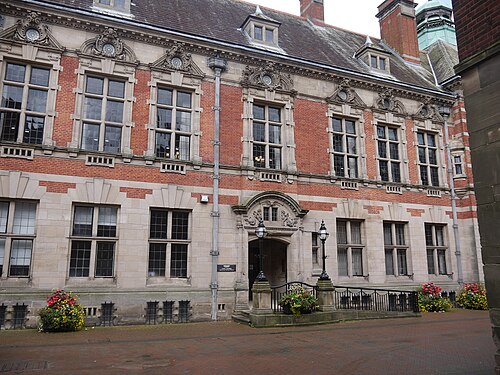
Photo: Guy Cockin · CC BY-SA 4.0 · Wikimedia Commons
People
Population
Estimates recorded for Staffordshire, 2012–2022.
Residents, 2022886,284+4.0% since 2012
Land area2,620.3km²1,011.7 sq mi
Density338/ km²people per square kilometre
Rank by population#10of 382 UK councils · #10 in England
Population estimates3 data points
852.1K875.2K886.3K
201220182022
Same region, same type
All councils in West MidlandsOther county councils in West Midlands
Elections
62 county electoral divisions
Divisions are built from district wards (ONS best-fit lookup); residents are the Census 2021 totals of those wards.
| Division | District | Wards | Residents |
|---|---|---|---|
| Audley & Chesterton | Newcastle-under-Lyme | 2 | 14,062 |
| Biddulph North | Staffordshire Moorlands | 3 | 11,978 |
| Biddulph South & Endon | Staffordshire Moorlands | 6 | 21,581 |
| Bradwell & Porthill | Newcastle-under-Lyme | 3 | 19,903 |
| Brereton & Ravenhill | Cannock Chase | 2 | 15,372 |
| Brewood | South Staffordshire | 5 | 27,025 |
| Burntwood North | Lichfield | 3 | 15,520 |
| Burntwood South | Lichfield | 4 | 20,061 |
| Burton South | East Staffordshire | 3 | 28,976 |
| Burton Tower | East Staffordshire | 2 | 13,651 |
| Burton Town | East Staffordshire | 2 | 18,383 |
| Burton Trent | East Staffordshire | 2 | 16,037 |
| Cannock Town | Cannock Chase | 3 | 26,418 |
| Caverswall | Staffordshire Moorlands | 4 | 13,163 |
| Chadsmoor | Cannock Chase | 3 | 27,173 |
| Cheadle & Checkley | Staffordshire Moorlands | 3 | 14,172 |
| Cheslyn Hay Village, Featherstone & Shareshill | South Staffordshire | 3 | 20,895 |
| Churnet Valley | Staffordshire Moorlands | 4 | 13,266 |
| Codsall | South Staffordshire | 2 | 12,704 |
| Dove | East Staffordshire | 4 | 33,315 |
| Eccleshall & Gnosall | Stafford | 3 | 20,712 |
| Etching Hill & The Heath | Cannock Chase | 2 | 15,594 |
| Great Wyrley & Essington | South Staffordshire | 3 | 16,167 |
| Hawks Green, Rawnsley & Cannock Wood | Cannock Chase | 3 | 25,186 |
| Hednesford North | Cannock Chase | 2 | 13,922 |
| Kidsgrove | Newcastle-under-Lyme | 2 | 14,729 |
| Kinver | South Staffordshire | 3 | 15,753 |
| Leek Rural | Staffordshire Moorlands | 6 | 14,191 |
| Leek South | Staffordshire Moorlands | 3 | 15,068 |
| Lichfield City North | Lichfield | 3 | 15,528 |
| Lichfield City South | Lichfield | 2 | 13,200 |
| Lichfield Rural East | Lichfield | 4 | 18,889 |
| Lichfield Rural North | Lichfield | 3 | 17,713 |
| Lichfield Rural South | Lichfield | 5 | 18,925 |
| Lichfield Rural West | Lichfield | 4 | 16,844 |
| May Bank & Wolstanton | Newcastle-under-Lyme | 3 | 20,219 |
| Needwood Forest | East Staffordshire | 3 | 24,371 |
| Newcastle Rural | Newcastle-under-Lyme | 3 | 12,387 |
| Newcastle South | Newcastle-under-Lyme | 4 | 21,728 |
| Norton Canes, Heath Hayes & Wimblebury | Cannock Chase | 2 | 18,377 |
| Penkridge | South Staffordshire | 3 | 16,286 |
| Perrycrofts | Tamworth | 2 | 15,257 |
| Perton | South Staffordshire | 4 | 16,040 |
| Silverdale & Knutton | Newcastle-under-Lyme | 5 | 25,413 |
| Stafford Central | Stafford | 5 | 29,308 |
| Stafford North | Stafford | 4 | 26,865 |
| Stafford South East | Stafford | 4 | 19,041 |
| Stafford South West | Stafford | 3 | 17,655 |
| Stafford Trent Valley | Stafford | 5 | 33,772 |
| Stafford West & Rural | Stafford | 3 | 14,235 |
| Stone Rural North | Stafford | 3 | 15,295 |
| Stone Urban | Stafford | 2 | 17,278 |
| Stretton | East Staffordshire | 2 | 21,683 |
| Talke & Red Street | Newcastle-under-Lyme | 2 | 14,702 |
| The Cotes/Two Rivers | Tamworth | 2 | 15,104 |
| The Heaths | Tamworth | 2 | 16,042 |
| Uttoxeter Rural | East Staffordshire | 5 | 31,799 |
| Uttoxeter Town | East Staffordshire | 2 | 14,021 |
| Watling | Tamworth | 4 | 32,307 |
| Westlands, Thistleberry & Keele | Newcastle-under-Lyme | 3 | 16,901 |
| Wilnecote | Tamworth | 2 | 16,995 |
| Wombourne | South Staffordshire | 2 | 13,225 |
Visit
Council offices
Offices, town halls and local council offices in the area.
Source: Wikidata Q21694786 (CC0)Figures as recorded with their reference year; boundaries may have changed since.