- Home
- Councils
- Scottish council areas
- Shetland Islands
Scottish council areaCurrentS12000027
Shetland Islands Council
Local authority area: Shetland Islands · Sealtainn
Shetland Islands is a scottish council area in Scotland. It covers 1,468.0 km² and had 22,920 residents in 2019 — about 16 people per km². The authority dates from 1996. The council is based in Lerwick.
Town hall in the administrative centreLerwick Town Hall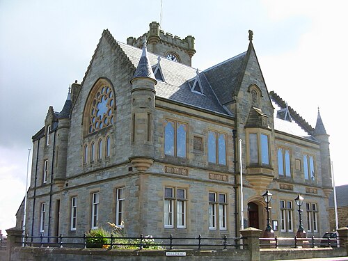
Photo: lost penguin · CC BY-SA 2.0 · Wikimedia Commons
People
Population
Estimates recorded for Shetland Islands, 2001–2019.
Residents, 201922,920+4.4% since 2001
Land area1,468.0km²566.8 sq mi
Density16/ km²people per square kilometre
Rank by population#379of 382 UK councils · #31 in Scotland
Population estimates17 data points
22.1K22.2K22.2K22.4K22.5K22.8K23.1K23.2K23.2K23.2K23.2K23.1K23K22.9K
20042005200620072008200920102011201220142015201720182019
History
How the council came to be
- 1996Created
Shetland Islands became a local authority area.
Same region, same type
All councils in ScotlandOther scottish council areas in Scotland
Elections
7 electoral wards
Westminster
Constituencies
Source: Wikidata Q47134 (CC0)Figures as recorded with their reference year; boundaries may have changed since.